
Tecnologías de predicción de tráfico: cómo los algoritmos aprenden del comportamiento al volante
In recent years, the rapid advancement of technology has transformed how cities and commuters approach traffic management. Central to this evolution are sophisticated prediction algorithms capable of analyzing vast amounts of data to forecast traffic conditions with remarkable accuracy. But what exactly powers these capabilities? At their core, these algorithms learn from the behaviors of drivers—to predict where congestion will occur, when roads might become bottlenecks, and how traffic flow can be optimized. The process is akin to teaching a machine how humans respond to various stimuli on the road, enabling it to anticipate and adapt to dynamic situations in real time. Much of this predictive power stems from artificial intelligence and machine learning techniques that process data gathered from a multitude of sources—traffic cameras, GPS devices, mobile apps, and sensor networks embedded in the road infrastructure. These data streams offer a snapshot of current traffic conditions, but their true value lies in historical patterns and behavioral insights. By analyzing how drivers typically respond to rush hours, weather changes, construction zones, or accidents, algorithms learn to recognize patterns and predict future congestion points before they even happen. For instance, if a certain route consistently experiences slowdowns during late afternoons, the system learns to issue proactive alerts or suggest alternative paths to alleviate pressure. A crucial element of these technologies is their ability to adapt and improve over time. As more data is collected, algorithms refine their predictions, becoming more precise and reliable. This feedback loop allows them not only to foresee traffic jams but also to recommend strategic interventions—like adjusting traffic light timings or rerouting vehicles—to minimize delays. Moreover, the integration of vehicle-to-infrastructure communication systems means that cars can receive real-time updates, enabling drivers to make informed decisions based on predictive insights. The implications of this technology extend beyond mere convenience. Enhanced traffic prediction can lead to reduced emissions, lower fuel consumption, and improved safety on the roads. By preemptively managing congestion, cities can optimize their transportation networks, making urban mobility smoother and more sustainable. However, behind these impressive applications lies the complexity of modeling human behavior—an unpredictable yet patterned phenomenon. Researchers and engineers continuously work to understand and simulate the subtle nuances of driver decisions, such as how individuals respond to traffic signals, congestion levels, or even their own habits. In conclusion, the fusion of behavioral data and intelligent algorithms has opened new horizons in traffic prediction. These systems learn from the collective experience of drivers, adapting to evolving traffic patterns and helping to shape smarter, more responsive transportation networks. As technology progresses, the dream of congestion-free commutes and smarter cities becomes increasingly attainable, demonstrating how the fusion of human behavior understanding and machine learning is transforming urban mobility.

Uso de redes neuronales en el análisis visual de transformaciones arquitectónicas
In recent years, the integration of neural networks into the field of architecture has revolutionized how professionals analyze and interpret design transformations. Traditionally, understanding architectural modifications relied heavily on manual inspections, sketches, and subjective assessments, which often limited the scope and precision of analysis. However, with the advent of deep learning and computer vision, these methods are being complemented—and in many cases, replaced—by automated, highly accurate systems capable of discerning subtle changes across complex structures. At the core of this technological leap are neural networks, especially convolutional neural networks (CNNs), which excel at processing visual data. These models are trained on vast datasets of images capturing architectural elements before and after transformations, enabling them to identify and classify differences with remarkable accuracy. For instance, a neural network can be employed to compare two images of a historic building—one from original plans and another post-restoration—to detect minute alterations such as changes in facade details, window placements, or structural reinforcements. This capability not only aids in documentation and preservation efforts but also provides architects and engineers with detailed insights that might be overlooked by the human eye. Furthermore, neural networks facilitate the visualization of complex transformations through generative models like Generative Adversarial Networks (GANs). These models can simulate potential future transformations or reconstruct missing parts based on learned patterns, offering architects a glimpse into various design possibilities or restoration scenarios. Such tools are invaluable, especially in restoration projects where historical accuracy is paramount or in adaptive reuse projects where existing structures are repurposed. The application of neural networks also significantly enhances the efficiency of architectural analysis workflows. Tasks that traditionally required days of manual review can now be automated, allowing professionals to focus more on interpretation and decision-making. For example, urban planners can use these technologies to assess the impact of new developments on cityscapes quickly, and conservationists can monitor physical changes over time with minimal effort. Despite these advances, challenges remain. Neural networks require extensive training data, which can be difficult to compile for unique or rare architectural features. Moreover, the interpretability of AI outputs remains a concern, as decisions made by these models can sometimes be opaque, necessitating a careful validation process by human experts. Nonetheless, ongoing research continues to address these issues, paving the way for more reliable and integrated AI-driven solutions. In sum, the use of neural networks in visual analysis of architectural transformations offers a powerful toolkit for modern architecture. It streamlines workflows, enhances precision, and opens new avenues for innovation in design, preservation, and urban planning. As these technologies evolve, their role in shaping the built environment is poised to expand, fostering a future where digital intelligence and human creativity work hand in hand to transform our cities and heritage sites.

Cómo las APIs de datos abiertos están transformando la planificación urbana en tiempo real
In recent years, the landscape of urban planning has experienced a significant transformation, driven largely by the advent of open data APIs. These digital tools have revolutionized how cities collect, analyze, and respond to the dynamic needs of their communities. Previously, urban planning relied heavily on periodic reports, surveys, and static datasets that often lagged behind real-world developments. Today, however, open data APIs provide a continuous influx of real-time information—from traffic flow and public transportation usage to air quality measurements and energy consumption patterns—allowing planners to make more informed and immediate decisions. The integration of open data APIs into urban management systems enables a level of agility that was unthinkable a decade ago. Cities can now monitor congestion hotspots during rush hours and deploy traffic management solutions almost instantaneously. For example, by accessing live data from sensors embedded in streets and transit systems, city officials can optimize traffic signals to reduce congestion and improve commute times. This immediate feedback loop not only enhances mobility but also reduces pollution levels and overall carbon footprint, aligning with broader sustainability goals. Moreover, open data APIs foster greater citizen participation in urban development projects. Residents can access real-time data on public safety, service outages, or environmental concerns, empowering them to make more informed choices and participate actively in civic discourse. Some cities have even developed platforms that allow residents to contribute data—such as reporting potholes or illegal dumping—further enriching the data ecosystem. This democratization of information leads to more transparent governance and accelerates problem-solving processes. Data interoperability is another critical aspect of these APIs. When different departments or agencies share and connect their data through open APIs, it creates a comprehensive picture of urban dynamics. For instance, combining transportation data with land use patterns can reveal insights into how zoning policies impact traffic or air quality, guiding more holistic planning strategies. This interconnected approach helps identify disparities, optimize resource allocation, and foster equitable development across neighborhoods. However, integrating open data APIs into urban planning is not without challenges. Ensuring data privacy and security remains paramount, especially when dealing with personal or sensitive information. Additionally, disparities in technological capacity among cities can hinder widespread adoption, as some municipalities lack the necessary infrastructure or expertise to fully leverage these tools. There is also the ongoing need for standardization to ensure data consistency and compatibility across different systems. Despite these hurdles, the potential for open data APIs to transform urban planning is immense. Cities around the world are increasingly adopting these technologies to create smarter, more responsive, and more sustainable urban environments. As these digital ecosystems mature, they promise a future where urban planning is more data-driven, participatory, and capable of adapting swiftly to the ever-changing needs of their inhabitants.
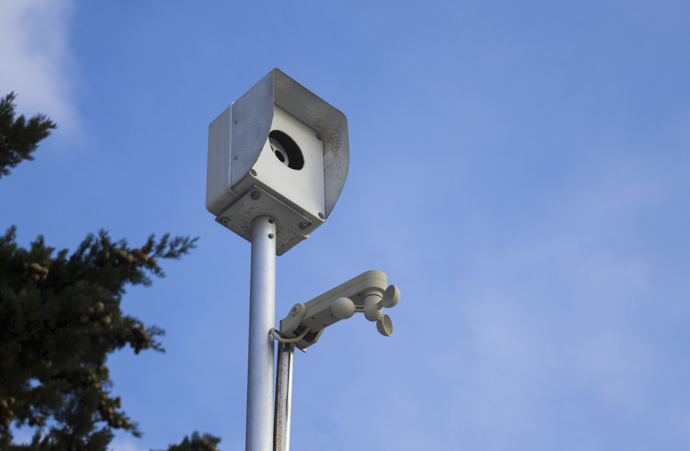
IoT y alumbrado urbano: cuando las farolas se convierten en sensores ambientales
In recent years, the integration of Internet of Things (IoT) technology into urban infrastructure has revolutionized how cities manage their resources and respond to environmental challenges. One of the most innovative developments in this realm is the transformation of traditional street lighting into intelligent sensor networks. Gone are the days when streetlights simply illuminated the streets during nighttime hours. Today’s smart lampposts are evolving into multifaceted hubs that continuously monitor the environment, providing valuable data that can improve urban living conditions and promote sustainability. This shift in urban infrastructure is driven by the need for cities to become smarter, more efficient, and more responsive to their inhabitants’ needs. As cities struggle with issues like air pollution, heat islands, noise pollution, and sudden weather changes, having real-time data becomes crucial for effective decision-making. By equipping existing streetlights with sensors that can detect pollutants, measure temperature and humidity, track noise levels, and even monitor light pollution, municipalities are creating a network of environmental sensors seamlessly integrated into their daily operations. The concept of "smart lighting" leverages IoT platforms to connect these sensor-equipped lamps to centralized control systems. These systems analyze the collected data, providing city authorities with insights that can inform policies, optimize resource allocation, and trigger automated responses. For example, if air quality sensors detect pollution levels exceeding safe thresholds, the system can activate alerts for residents or suggest temporary traffic restrictions to reduce emissions. Similarly, data on noise pollution can guide city planners in implementing measures to mitigate excessive sound levels in busy districts. Beyond environmental monitoring, these intelligent streetlights also contribute to energy efficiency and cost savings. Adaptive lighting systems can adjust brightness based on pedestrian activity or ambient light conditions, ensuring that energy is used judiciously without compromising public safety. This dynamic approach not only reduces electricity consumption but also extends the lifespan of the lighting infrastructure, translating into long-term financial benefits for city budgets. Implementing IoT-enabled lighting infrastructure also opens new avenues for public engagement and data democratization. Citizens can access real-time environmental data through mobile apps or city websites, fostering greater awareness and encouraging community participation in sustainability initiatives. Furthermore, the data collected can serve as a foundation for innovative urban planning strategies, such as identifying pollution hotspots or areas prone to heat islands, enabling targeted interventions. However, this technological leap is not without challenges. Concerns about data privacy, cybersecurity, and the initial investment costs require careful planning and robust security measures. Ensuring that sensitive data remains protected while maintaining transparency with the public is vital for sustaining trust in these smart city initiatives. Overall, the convergence of IoT technology and urban lighting infrastructure marks a significant step toward more sustainable and resilient cities. By transforming streetlights into environmental sensors, urban areas can become more proactive in managing their ecosystems, reducing pollution, conserving energy, and enhancing the quality of life for their residents. As this trend continues to evolve, it promises a future where cities are not just illuminated by lights but enlightened by data-driven insights that make urban living smarter and more sustainable.
La transición silenciosa: cómo el Edge Computing reemplaza los centros de datos centralizados en las ciudades
As cities around the world continue to grow and evolve into bustling hubs of activity and innovation, the backbone supporting this rapid development—traditional centralized data centers—begins to show signs of strain. These massive facilities, often located on the outskirts or in remote areas, are no longer efficient in handling the surging volume of data generated by connected devices, IoT networks, autonomous vehicles, and smart infrastructure. Enter edge computing: a transformative approach that is quietly reshaping the digital landscape of modern urban environments. Edge computing decentralizes data processing, bringing it closer to the source of data generation—be it street sensors, security cameras, or smart traffic lights. Instead of transmitting everything back to a central data center situated miles away, local nodes or micro data centers process information on-site, enabling faster response times, reduced latency, and significant improvements in bandwidth usage. This shift not only enhances the performance of real-time applications but also alleviates the burden on existing infrastructure, making city management more efficient and resilient. What makes this transition particularly compelling is its subtlety. It’s not a dramatic overhaul but a gradual shift driven by the necessity of supporting increasingly complex urban systems. For instance, smart traffic management now relies on edge computing to analyze vehicle flow and adjust signals almost instantly, reducing congestion and pollution. Emergency response systems leverage local data analysis to trigger quick actions without waiting for central approval. Even public safety measures, such as surveillance cameras and predictive crime analytics, benefit from localized processing, ensuring that critical decisions happen faster and more reliably. Furthermore, the adoption of edge computing aligns with broader trends toward sustainability. By processing data closer to its source, cities can significantly cut down on energy consumption associated with transmitting large volumes of data to distant data centers. This contributes to greener urban environments and supports the goals of smart city initiatives aimed at eco-friendly development. With advancements in miniaturization, energy-efficient hardware, and robust wireless connectivity—like 5G—edge computing nodes are becoming more affordable and easier to deploy across urban landscapes. However, this shift also introduces new challenges. Data security and privacy become more complex when processing is dispersed across multiple nodes rather than centralized control points. Ensuring compliance with data protection regulations, safeguarding against cyber threats, and managing the complexity of distributed systems require innovative solutions and collaborative efforts across public and private sectors. In essence, the transition to edge computing is a quiet revolution transforming cities into smarter, more responsive entities. While it may not draw headlines in the way large data centers have historically done, this evolution is fundamental to building urban environments that are more efficient, sustainable, and capable of meeting the demands of the future. As cities continue to embrace this decentralized approach, we are witnessing the dawn of a new era where data acts not just as a resource but as an integral part of urban life—streamlined, localized, and more connected than ever before.
Retrofuturismo en diseño de dispositivos: el regreso de las formas antiguas con tecnología actual
El mundo del diseño contemporáneo ha visto una tendencia interesante y en cierto modo nostálgica: el retrofuturismo en la creación de dispositivos. Este movimiento combina la estética de épocas pasadas con las tecnologías más avanzadas del presente, dando lugar a objetos que parecen haber salido de una película clásica de ciencia ficción, pero que en realidad integran lo último en innovación tecnológica. La fusión entre lo antiguo y lo moderno no solo provoca una sensación estética atractiva, sino que también invita a reflexionar sobre cómo percibimos el futuro y la historia. Desde teléfonos que remiten a los radios de los años 50, con curvas suaves y acabados en metal pulido, hasta altavoces inspirados en la estética de las naves espaciales vintage, el retrofuturismo apuesta por rescatar y reinventar formas de épocas pasadas, pero con capacidades que superan lo imaginado en su tiempo. Este estilo a menudo desafía la línea entre lo funcional y lo decorativo, logrando que cada dispositivo no solo sea útil, sino también una pieza de arte en sí misma. La clave radica en la combinación de detalles retro con tecnología contemporánea: pantallas que parecen ser botones de uno de esos aparatos antiguos, pero que en realidad ofrecen interfaces táctiles de última generación; acabados en bronce, madera o plásticos de aspecto vintage, integrados con componentes digitalizados y conectividad inteligente. Un aspecto fascinante del retrofuturismo en el diseño de dispositivos es cómo despierta una sensación de familiaridad y nostalgia, al mismo tiempo que proyecta una visión innovadora del futuro. Muchos diseñadores optan por utilizar formas curvilíneas y elementos gráficos que remiten a la ciencia ficción clásica, buscando un equilibrio entre la etapa dorada del diseño industrial y las necesidades modernas. Este estilo no solo responde a una preferencia estética, sino que también refleja una tendencia cultural: la vuelta a lo artesanal, lo vintage y lo sostenible, en contrapunto a la producción en masa de tecnológicamente desechable. Además, el retrofuturismo en dispositivos fomenta un enfoque más consciente y personalizado. En lugar de adoptar una estética minimalista y fría, estos objetos invitan a la expresión individual y a la decoración con objetos que cuentan historias y transmiten carácter. Es una forma de reencontrarse con un pasado imaginado, reinterpretar esas visiones del futuro que estaban en las películas y cómics de décadas pasadas, y actualizarlas con tecnologías que van desde asistentes virtuales hasta inteligencias artificiales integradas. En definitiva, el retrofuturismo en diseño de dispositivos no solo es una tendencia estética, sino un puente que une distintas épocas y sensaciones. Nos permite soñar con un futuro que recuerda al pasado, mientras disfruta de las prestaciones de la tecnología moderna. Esta corriente invita a pensar que, quizás, el futuro que imaginamos puede ser tan acogedor, elegante y lleno de carácter como las visions románticas de ciencia ficción que todos hemos disfrutado alguna vez. Al final, se trata de celebrar la creatividad en su máxima expresión: traer lo antiguo a la vida, con un toque de innovación que nos invita a explorar nuevas maneras de experimentar y relacionarnos con la tecnología.